Back كاساكاليندا Arabic کاساکالندا AZB Казакаленда Byelorussian Казакаленда Bulgarian Casacalenda Breton Casacalenda Catalan Казакаленда CE Casacalenda (munisipyo) CEB Casacalenda German Casacalenda Esperanto
Casacalenda | |
|---|---|
| Comune di Casacalenda | |
 | |
| Coordinates: 41°44′N 14°51′E / 41.733°N 14.850°E | |
| Country | Italy |
| Region | Molise |
| Province | Campobasso (CB) |
| Government | |
| • Mayor | Sabrina Lallitto |
| Area | |
| • Total | 67.28 km2 (25.98 sq mi) |
| Elevation | 670 m (2,200 ft) |
| Population (30 November 2017)[2] | |
| • Total | 2,054 |
| • Density | 31/km2 (79/sq mi) |
| Demonym | Casacalendesi |
| Time zone | UTC+1 (CET) |
| • Summer (DST) | UTC+2 (CEST) |
| Postal code | 86043 |
| Dialing code | 0874 |
| Website | Official website |
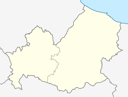
Casacalenda (Molisan dialect Casechelenne; Kalena) is a comune (municipality) in the Province of Campobasso in the Italian region Molise, located about 25 kilometres (16 mi) northeast of Campobasso.
The Greek historian Polybius mentions a battle in 217 BC between the Roman army, based in Kalene, and Hannibal, based in Gerione (now a hamlet of Casacalenda).[3] The name might have been derived from the Latin Kalendae or Kalends, the first day of the month in the Roman calendar.[3]
Among its churches is Santa Maria Maggiore.
Casacalenda borders the following municipalities: Bonefro, Guardialfiera, Larino, Lupara, Montorio nei Frentani, Morrone del Sannio, Provvidenti, Ripabottoni.
- ^ "Superficie di Comuni Province e Regioni italiane al 9 ottobre 2011". Italian National Institute of Statistics. Retrieved 16 March 2019.
- ^ All demographics and other statistics: Italian statistical institute Istat.
- ^ a b "Casacalenda, Campobasso - Molise - Italy". Archived from the original on 2009-01-30. Retrieved 2009-01-24. , accessed 24 January 2009


